
Beginners
First flights go in the book
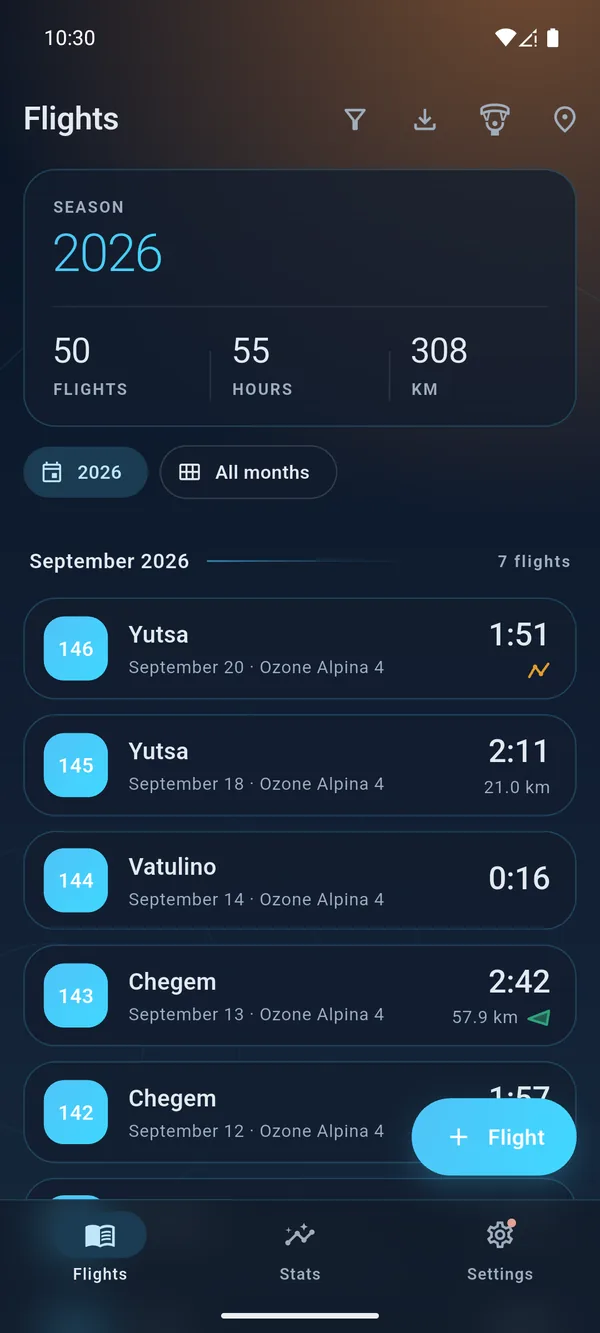
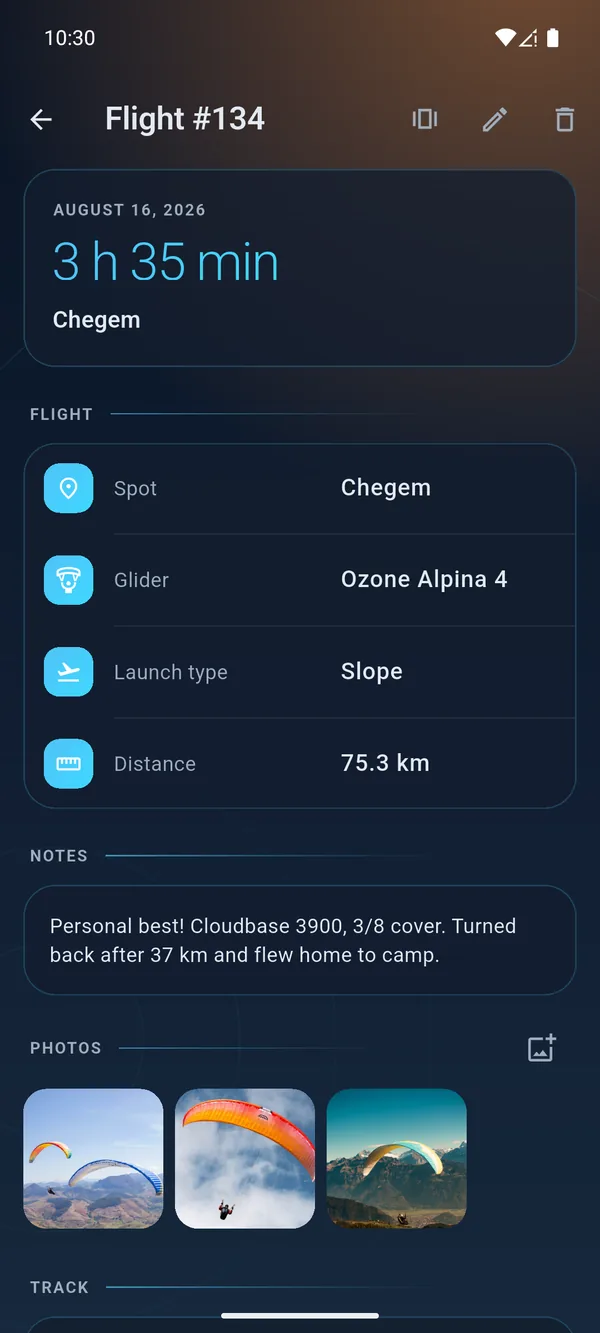
Log a flight in a couple of taps: spot, glider and launch type fill themselves in. Progress by month, first records and story pictures — your flight and “Year in review”.

Android · Windows · macOS · free
All your flights, tracks, gear and spot weather in one app. From your first hop to hundred-kilometre cross-country routes.

You can install it from the store: no “unknown sources”, and updates arrive by themselves.
Who it's for
A simple flight book for beginners. Track analysis for cross-country pilots. Precise hours for competitors.
Log a flight in a couple of taps: spot, glider and launch type fill themselves in. Progress by month, first records and story pictures — your flight and “Year in review”.
Send a track from XCTrack with “Share”, then explore it in the 3D player with terrain and a thermal wall, plus launch weather from four models.
Statistics by year, glider and spot, PDF and CSV reports for your club and ratings, KML and GPX export.
Features
Tap “Share” in XCTrack and WingLog fills in the date, duration and route distance, picks the glider by the name in the track and remembers the launch coordinates. If the track is already in your logbook, the app warns you. Your whole XContest history, a batch of tracks, a ZIP archive or GPX and FIT files are accepted in one go.
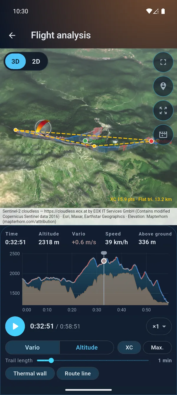
Real terrain with satellite imagery and a thermal wall in 3D, the track on a map in 2D, an altitude chart you can scrub through, and fast playback.
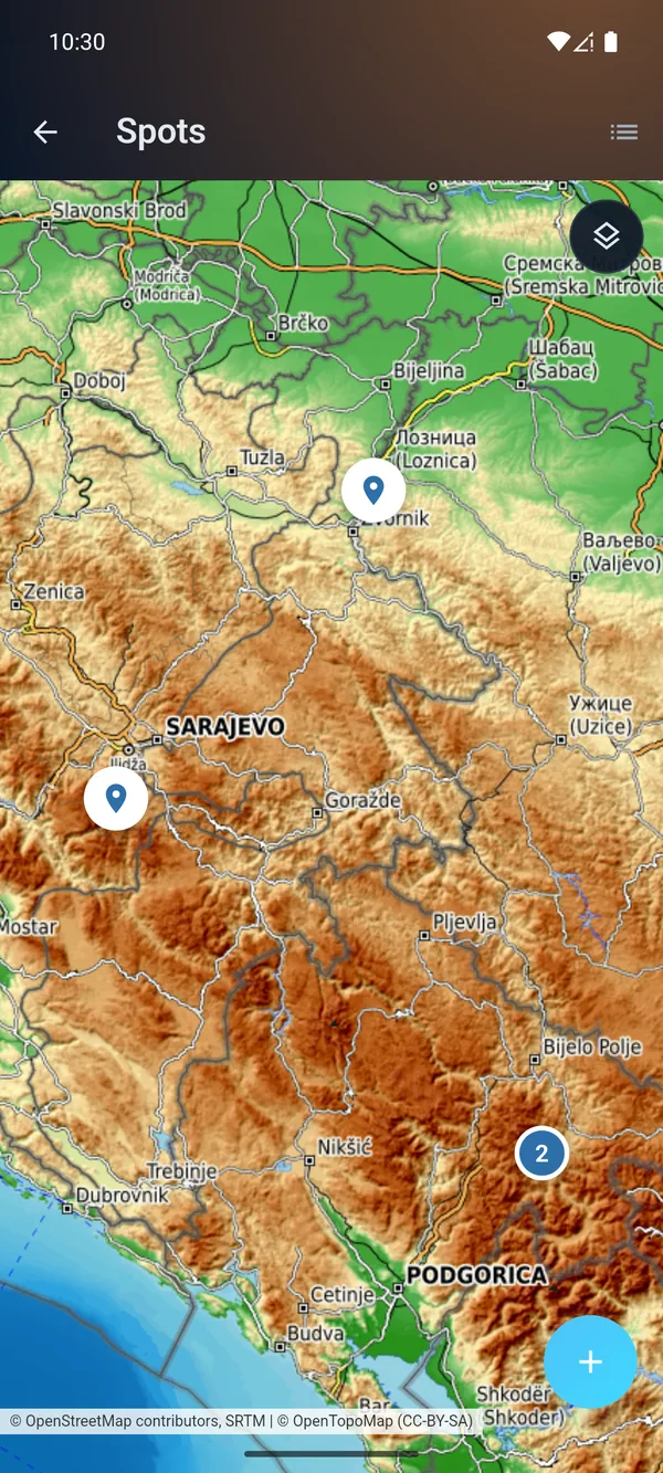
See it →All your spots on a map, the hours for each, and the Map, Satellite, Terrain and Hybrid layers.
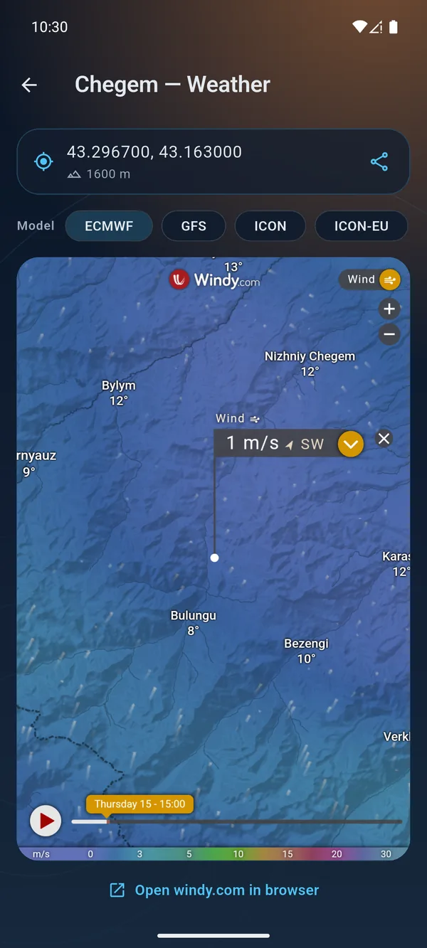
Windy for the spot's coordinates: ECMWF, GFS, ICON, ICON-EU. Wind in m/s, and the spot's coordinates go to a friend in one tap.
Hours, kilometres, records, the season by month. Logbook in PDF and CSV — for your club and ratings.
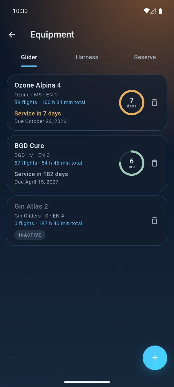
Wings, harnesses and reserves in one list, with hours for every wing. Set the last service date and an interval — a countdown ring appears on the gear tile showing how many days are left until the reserve repack or service. Green means all good, amber means 30 days or less, red means overdue.
One logbook on your phone in the field and on your computer at home — synced over your local network.
How it works →Inside WingLog
Real app screens. Dark and light themes, Russian and English.
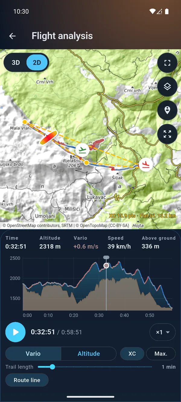
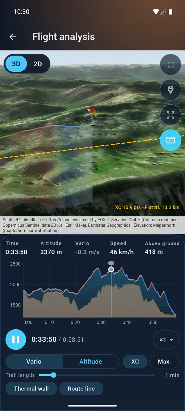
Flight analysis
A 3D scene and a map, an altitude chart and readouts — on one screen and one clock. The track colour shows the vario: where it lifted and where it sank. Drag the marker along the chart and the pilot moves along the track.
Switch on the fly
The flight doesn't stop: time, speed and the pilot's position stay put, only the point of view changes. In 3D you see how a thermal built up; in 2D, exactly where you flew.
3D
2D
New · tool
A track from your vario to GPX for Strava and navigators, a recording from your watch to IGC for your flight logbook, and the other way round. Right on the site, nothing to install.
New · version 1.6.4
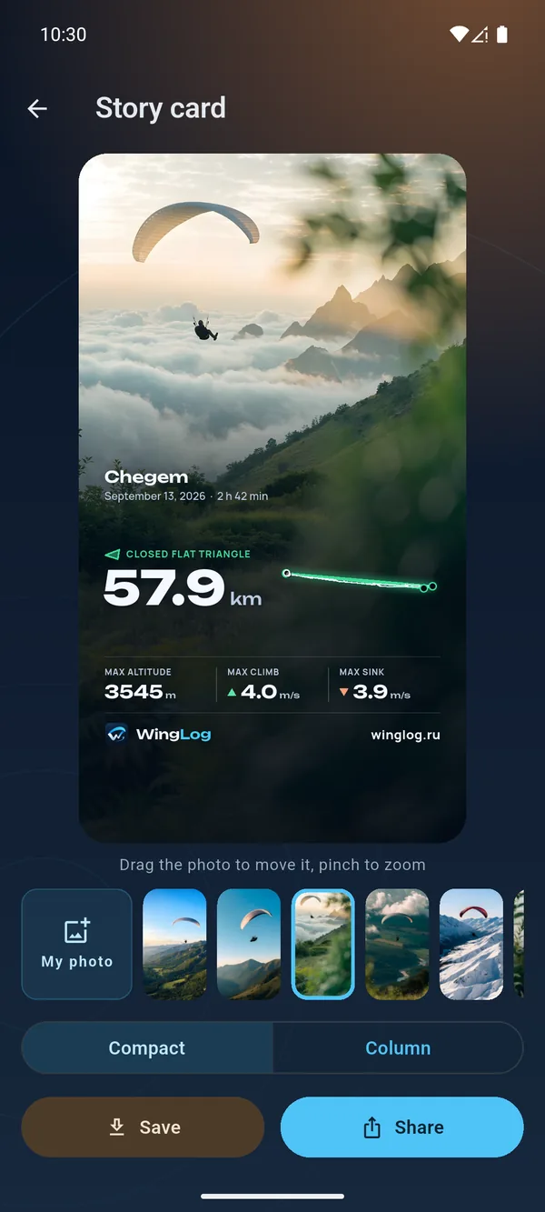
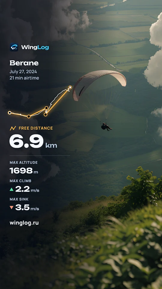
One tap in the flight card and a vertical picture is ready: the flight numbers over your photo. There is room left in the frame for your own text.


Statistics
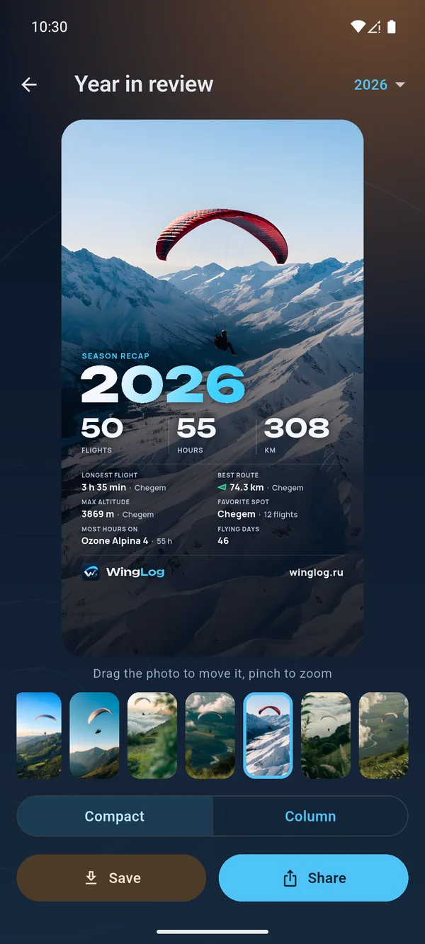
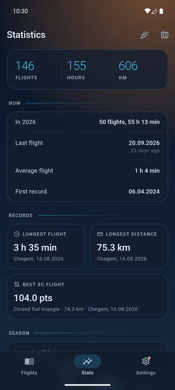
Hours by year, glider and spot. Records for time and distance. The season by month, a congratulation when you beat your own record — and “Year in review” as a story picture.
Weather and map
All your spots on one map, with the hours for each. Open any of them and see the Windy forecast for its exact coordinates: four models to choose from, wind in m/s.
Sync
Pair your devices with a 6-digit code — and flights, tracks, gear and photos are the same on both. If a record was changed in both places, WingLog shows both versions and lets you choose. Everything goes over your local network.
481592
Roadmap
Download
When installing, Android will ask you to allow installation from this source — that happens with every app that is not from a store. If you would rather not allow anything — get the RuStore version.
The Mac version is new and has been tested less than the others. If something doesn't work as it should, please let us know.
Updates come from inside the app. You won't need to download the archive again: when a new version is out, WingLog tells you itself, and you install it with the “Update” button (Settings → Updates). If an update didn't install for some reason, download a fresh archive here and replace the app in Applications — your flights and tracks stay where they are.
If there is no “Open Anyway” button or macOS says the app is damaged: open the Terminal app, paste the line xattr -dr com.apple.quarantine /Applications/WingLog.app and press Enter, then launch WingLog again.
What's new in version 1.6.5 and how the app has changed before — see the Version history.

Support the author
WingLog is made by a pilot for pilots, who puts flying experience into every line of code.
Your donation is a thermal for the project: it gives the strength for new features and more frequent updates. Even the price of a cup of coffee at launch helps WingLog climb higher. Thank you for flying with us!
Support via CloudTips
Point your phone's camera at it
About the author
Questions
Yes, the app page in RuStore. The store version works the same and is updated through the store. The Windows and Mac versions are available only here, on the site.
Yes. Right now the app is completely free: no subscriptions, no ads and no paid features. Development is supported by voluntary donations.
Yes, in the future. We plan to add extra, very useful features — for a minimal fee. Right now everything in the app is free.
Only on your device. You can save a backup to a ZIP file, and sync between your own devices over the local network.
No — the logbook, statistics and tracks work offline. The internet is only needed for maps, 3D terrain and weather.
Import — IGC, GPX and FIT: one file at a time, in batches or as a ZIP archive, including straight from XCTrack via “Share”. Your whole XContest history can be moved over in one go: the “Download: IGC” archive and the JSON export. Export — KML for Google Earth and GPX for navigators.
Two ways. Local network sync — between Android and Windows, in both directions (the Mac version can do it too, but sync there has been tested little so far). Or a backup: one ZIP file with all your flights, tracks and photos, which you restore on another device.
Enter them in a glider's “Hours before this logbook” field — the hours go into your total, and you don't have to enter old flights one by one.
Yes, in the future. An iPhone version is already on the roadmap, and for now WingLog is available for Android, Windows and macOS.

Find us on social media
Follow WingLog news
Version news, flight breakdowns in “Flight analysis” and answers to questions. Tell us what the app is missing: I read every message.